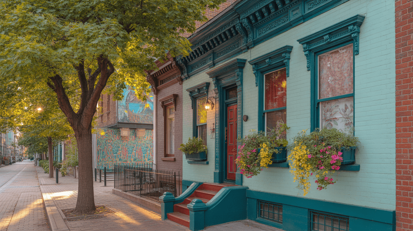
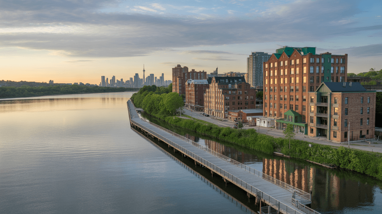
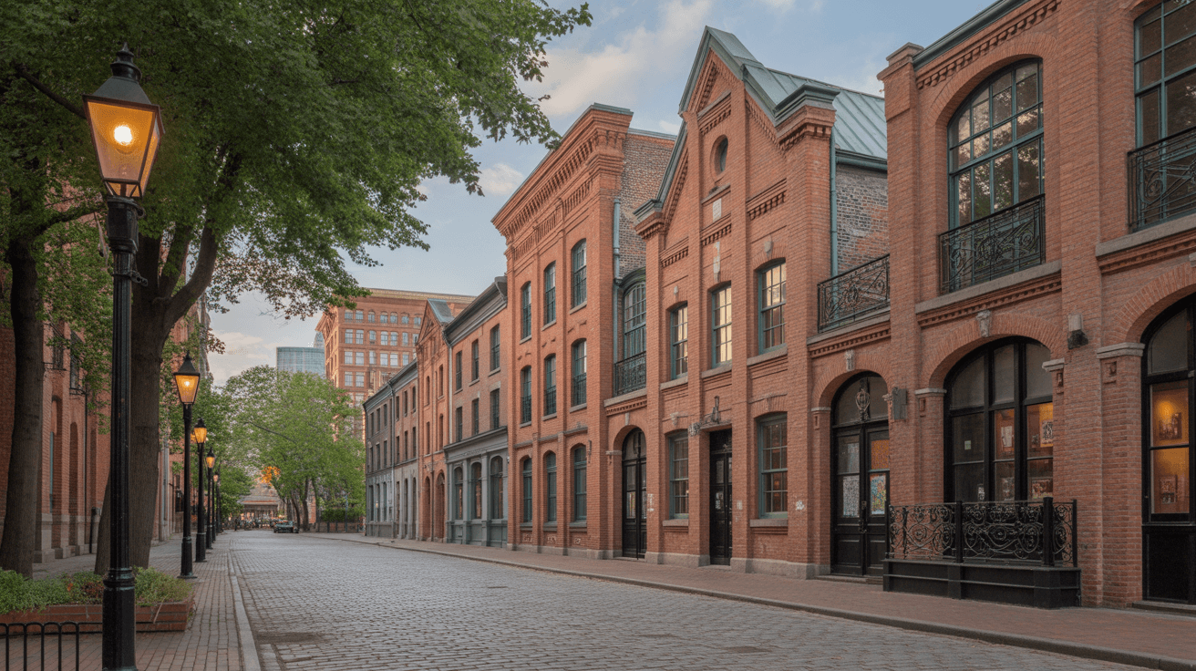
Toronto.Community
HomeNeighborhoodsEventsProfessionalsBlogGuidesContact
Toronto.Community
HomeNeighborhoodsEventsProfessionalsBlogGuidesContact

Explore Toronto's Neighborhoods

From the upscale boutiques of Yorkville to the sandy shores of The Beaches, discover what makes each of Toronto's 164+ neighborhoods unique.

Browse AllCompare Neighbourhoods

Explore the Map

Click on any neighborhood marker to learn more

Loading map...

164 neighborhoods

Featured Neighbourhoods

Distillery District neighborhood in Toronto
FeaturedArtsy
95

Distillery District

Where History Meets Art

The Distillery District is a pedestrian-only village set in the former Gooderham and Worts Distillery, one of the largest and best-preserved collections of Victorian industrial architecture in North America. This National Historic Site has been transformed into a vibrant arts, culture, and entertainment destination featuring galleries, boutiques, restaurants, and the famous Toronto Christmas Market.

King Streetcar (504/514)
High Park neighborhood in Toronto
FeaturedNatural
87

High Park

Nature Meets Urban Living

High Park is named after Toronto's largest public park, a 400-acre urban oasis featuring hiking trails, a zoo, sports facilities, and the famous cherry blossoms that draw thousands each spring. The surrounding neighborhood offers a perfect balance of nature access and urban amenities, with beautiful residential streets, good schools, and easy access to downtown via the Bloor subway line.

High Park Station (Line 2)
Leslieville neighborhood in Toronto
FeaturedHip
92

Leslieville

Toronto's Hip East Side

Leslieville has undergone a remarkable transformation from a working-class neighborhood to one of Toronto's most sought-after areas for young professionals and families. Queen Street East through Leslieville is a treasure trove of independent coffee shops, farm-to-table restaurants, antique stores, and design studios. The neighborhood perfectly balances its industrial heritage with a modern, creative sensibility.

Queen Streetcar (501)
Liberty Village neighborhood in Toronto
FeaturedUrban
85

Liberty Village

Toronto's Urban Creative Hub

Liberty Village is Toronto's premier live-work-play neighborhood, built on the site of former industrial lands. This master-planned community has become a magnet for tech startups, creative agencies, and young professionals who appreciate its modern condos, trendy restaurants, and entrepreneurial energy. The neighborhood seamlessly blends converted industrial buildings with sleek new developments.

Exhibition GO Station, King Streetcar
Queen West neighborhood in Toronto
FeaturedTrendy
96

Queen West

The Art & Design District

Queen West has been named one of the world's coolest neighborhoods by Vogue magazine, and for good reason. This eclectic stretch is the beating heart of Toronto's art and fashion scene, lined with independent boutiques, vintage shops, cutting-edge galleries, and some of the city's best restaurants and bars. From Trinity Bellwoods Park to the trendy West Queen West extension, this is where Toronto's creative class lives and plays.

Queen Streetcar (501)
Roncesvalles neighborhood in Toronto
FeaturedCommunity-oriented
94

Roncesvalles

Toronto's European Village

Roncesvalles Village, affectionately known as 'Roncy,' offers a distinctly European feel with its Polish heritage, tree-lined streets, and strong sense of community. This family-friendly neighborhood features an eclectic mix of independent shops, cafes, and restaurants along Roncesvalles Avenue, with High Park at its doorstep. It's the kind of place where neighbors know each other and local businesses thrive.

King & Queen Streetcars
The Beaches neighborhood in Toronto
FeaturedRelaxed
89

The Beaches

Toronto's Lakeside Paradise

The Beaches (or The Beach, depending on who you ask) is Toronto's quintessential lakeside neighborhood, offering a resort-like atmosphere year-round. With its stunning boardwalk along Lake Ontario, sandy beaches, and a charming main street lined with local shops and cafes, this neighborhood feels like a small town within the big city. It's the perfect blend of urban convenience and beachside relaxation.

Queen Streetcar (501)
Yorkville neighborhood in Toronto
FeaturedUpscale
98

Yorkville

Toronto's Most Prestigious Address

Yorkville is Toronto's premier luxury destination, featuring world-class shopping along Bloor Street, fine dining establishments, and some of the city's most exclusive residential addresses. Once a bohemian village in the 1960s, it has transformed into Canada's answer to Fifth Avenue, where designer boutiques sit alongside art galleries and five-star hotels.

Bloor-Yonge Station (Line 1 & 2)

All Neighbourhoods

Agincourt North neighborhood in Toronto
Multicultural
25

Agincourt North

A Thriving Crossroads of Culture and Community

Agincourt North sits at the upper reaches of Scarborough, bounded roughly by Steeles Avenue to the north and Finch Avenue to the south, with Midland Avenue and Kennedy Road forming its east-west spine. This is one of Toronto's most authentically multicultural neighbourhoods, where Chinese, South Asian, Filipino, and Caribbean communities have built a vibrant commercial and residential tapestry over decades. The stretch of Kennedy Road between Steeles and Finch is lined with Asian supermarkets, dim sum restaurants, and bubble tea shops that draw visitors from across the GTA. Residentially, Agincourt North is a mix of post-war bungalows, split-levels, and newer infill townhome developments. Families are drawn here by the relatively affordable housing stock, strong public schools, and the sheer convenience of having world-class grocery shopping steps from home. L'Amoreaux Park and its community centre anchor the western portion, offering sports fields, a pool, and programming year-round. While the neighbourhood sits well north of downtown, it benefits from strong bus connections along Kennedy and Finch, and the Kennedy subway station at the south end of Line 2 is a reasonable bus ride away. The 401 and 404 highways are close by for drivers, making Agincourt North a practical base for commuters who prize community character over urban density.

Kennedy Road buses, Finch East bus, Kennedy Station (Line 2) nearby
Agincourt South-Malvern West neighborhood in Toronto
Diverse
25

Agincourt South-Malvern West

Where Scarborough's Neighbourhoods Weave Together

Agincourt South-Malvern West occupies a broad swath of central Scarborough, stretching south from Finch Avenue toward Sheppard Avenue East, with Kennedy Road running through its heart. This is a neighbourhood defined by its diversity — over a hundred languages are spoken within its borders, and that multilingual energy shows up in the shopping plazas, places of worship, and community organizations that dot every major intersection. Housing here is a characteristic Scarborough blend of 1960s and 1970s detached homes with generous lots, postwar apartment towers near Sheppard, and townhouse clusters built during the city's suburban expansion. The Malvern West portion trends slightly more residential and quiet, with tree-lined crescents that feel removed from the commercial bustle of Kennedy and Sheppard. Agincourt Mall remains a neighbourhood hub for everyday errands. Transit access improved significantly with the extension of Line 2 into Scarborough, and residents along Sheppard can catch express buses heading both east and west. The neighbourhood's parks — including Agincourt Park and its baseball diamonds — provide breathing room amid the suburban fabric, and local community centres run programming that reflects the area's rich demographic mix.

Sheppard East buses, Kennedy Station (Line 2), Scarborough RT corridor
Alderwood neighborhood in Toronto
Lakeside
25

Alderwood

South Etobicoke's Quiet Gem by the Lake

Tucked into the southwest corner of Etobicoke between the Gardiner Expressway and Lake Ontario, Alderwood is one of those Toronto neighbourhoods that longtime residents guard as a well-kept secret. The streets here are lined with modest post-war bungalows and backsplits, many lovingly maintained or thoughtfully renovated by families who have called the area home for generations. Brown's Line and Horner Avenue form the commercial arteries, with a scattering of local shops, bakeries, and family restaurants. The neighbourhood's greatest asset may be its proximity to green space and waterfront. Marie Curtis Park, which straddles the Etobicoke Creek at the western edge, offers a sandy beach, cycling trails, and an off-leash dog area that's one of the best in the city. Colonel Samuel Smith Park sits to the east along the lake, connecting to the Waterfront Trail and the Humber Bay Shores pathway network. Alderwood is car-friendly by design — the Gardiner and QEW are minutes away — but transit riders can connect via the Long Branch loop of the 501 streetcar or the Kipling bus routes heading north to Kipling Station on Line 2. It's a neighbourhood that appeals to young families and downsizers alike, offering genuine lakeside living without the price tags of the eastern waterfront.

Long Branch 501 streetcar loop, Kipling Station (Line 2) via bus
Annex neighborhood in Toronto
Bohemian
84

Annex

Toronto's Intellectual Heart, Bohemian to the Core

The Annex is one of Toronto's most storied neighbourhoods, a leafy enclave between Bloor Street and Dupont, stretching from Avenue Road west to Bathurst. It has long been the spiritual home of the city's academic and artistic class, owing to its proximity to the University of Toronto campus. The Victorian and Edwardian homes here — many with their distinctive peaked gables and wraparound porches — rank among the finest residential architecture in the city, and the neighbourhood was one of the first in Toronto to receive heritage designation. Bloor Street through the Annex is the main commercial strip, lined with independent bookshops like BMV Books, beloved restaurants such as By The Way Cafe and Pho Hung, and the legendary Honest Ed's site now transformed into the Mirvish Village redevelopment. The neighbourhood's cultural footprint punches well above its weight: the Bata Shoe Museum, the Royal Conservatory of Music, and numerous galleries call the area home. Resident demographics skew toward professors, graduate students, writers, and professionals who value walkability and intellectual community over suburban space. Transit is exceptional — Bathurst and Spadina stations bookend the neighbourhood on Line 1 and Line 2, and the Bloor streetcar and multiple bus routes ensure you rarely need a car. The Annex is the kind of neighbourhood where you'll run into someone you know at every coffee shop.

Spadina Station (Line 1 & 2), Bathurst Station (Line 2), Bloor streetcar
Avondale neighborhood in Toronto
Suburban
35

Avondale

A Midtown Pocket of Calm and Convenience

Avondale is a quiet residential neighbourhood in North York, nestled between Yonge Street to the east and Bathurst Street to the west, roughly centred around Wilson Avenue and the 401. It's the kind of neighbourhood that doesn't make headlines, and that's exactly why its residents love it. Streets of well-kept post-war bungalows and modest two-storey homes sit on generous lots, shaded by mature maples and oaks that create a canopy effect in summer. The Wilson Avenue commercial strip provides everyday essentials — supermarkets, dry cleaners, banks, and a rotating cast of family-run restaurants reflecting the area's diverse population. Viewmount Park and Glen Long Park offer local green space for dog walkers and playground-goers, while the larger Downsview Park and its event spaces are a short drive north. Transit is a strong suit for Avondale. Wilson Station on Line 1 sits at the neighbourhood's southern edge, providing direct subway access to both downtown and the northern suburbs. The Wilson bus runs the east-west corridor, and drivers appreciate the immediate access to Highway 401. For families seeking midtown convenience with a suburban pace of life, Avondale delivers reliably and affordably.

Wilson Station (Line 1), Wilson Avenue bus, Highway 401 access
Banbury-Don Mills neighborhood in Toronto
Planned
45

Banbury-Don Mills

Mid-Century Modern Living in the Don Valley

Banbury-Don Mills is a landmark in Canadian urban planning — it was part of the original Don Mills master-planned community developed in the 1950s by Macklin Hancock, one of the first comprehensively designed suburbs in the country. The neighbourhood's curving streets, cul-de-sacs, and generous green spaces were revolutionary at the time and still give the area a distinctly park-like feel that sets it apart from Toronto's grid-based neighbourhoods. The housing stock is a time capsule of mid-century Canadian suburbia: brick bungalows and split-levels with big backyards, interspersed with well-maintained apartment towers along Don Mills Road. The Shops at Don Mills, an open-air lifestyle centre at Don Mills Road and Lawrence, serves as the commercial and social hub, offering upscale retail, restaurants, and a farmers' market in season. The Don River valley ravine system runs along the neighbourhood's western edge, providing excellent trail access for hiking, running, and cycling. The Japanese Canadian Cultural Centre and Aga Khan Museum are nearby cultural anchors. Transit includes Don Mills Station on Line 4 (Sheppard) and frequent bus service along Don Mills Road. Banbury-Don Mills offers a rare combination: mid-century suburban charm within reasonable reach of downtown Toronto.

Don Mills Station (Line 4 Sheppard), Don Mills Road bus
Bathurst Manor neighborhood in Toronto
Established
25

Bathurst Manor

North York's Established Enclave with Deep Roots

Bathurst Manor occupies a wedge of North York between Bathurst Street, Wilson Avenue, and the 401, and it has one of the most distinctive neighbourhood identities in the northern half of the city. Historically home to a large Jewish community that settled here in the 1950s and 60s, the area retains much of that cultural character through its synagogues, kosher bakeries, and community organizations, even as newer waves of immigration have added to the mix. The housing is predominantly single-family — brick bungalows and side-splits from the neighbourhood's original build-out, with some owners adding second storeys or modern additions. Lots are generous by Toronto standards, and the quiet, winding residential streets feel distinctly suburban. Bathurst Street provides the commercial spine, with a steady mix of delis, pharmacies, and small shops. Wilson Station on Line 1 serves the southern edge of the neighbourhood, and the Bathurst bus provides connections southward. Drivers appreciate the proximity to Highway 401. Wilmington Park anchors the neighbourhood's recreation, with a community centre, tennis courts, and a popular outdoor pool. Bathurst Manor is a neighbourhood where people tend to stay for decades, drawn by the stability, the community ties, and the comfort of knowing their neighbours.

Wilson Station (Line 1), Bathurst Street bus (7)
Bay-Cloverhill neighborhood in Toronto
Upscale
99

Bay-Cloverhill

Downtown Elegance Where Bloor Meets Bay

Bay-Cloverhill sits at one of the most prestigious intersections in Toronto — the corridor where Bay Street's financial power meets Bloor Street's cultural and retail grandeur. This compact downtown neighbourhood stretches from Bloor south toward Wellesley, bounded by Yonge Street to the east and Avenue Road to the west. It's a neighbourhood of contrasts: soaring condominium towers and luxury apartment buildings coexist with the stately mansions of the Cloverhill district, some dating to the 19th century. Yorkville, Toronto's premier luxury shopping destination, forms the northern edge, with designer flagships, art galleries, and some of the city's finest restaurants concentrated along Bloor and Cumberland Streets. The Royal Ontario Museum and the Gardiner Museum anchor the cultural landscape, while Queen's Park and the University of Toronto campus provide green relief from the urban density. Bay Station on Line 2 places the entire city within easy reach. Living here means living at the centre of everything — world-class dining, theatre, shopping, and transit are all within walking distance. Residents tend to be professionals, empty nesters, and internationally mobile Torontonians who value the convenience and cosmopolitan energy of true downtown living. It's one of the most walkable neighbourhoods in Canada, with a Walk Score that reflects its extraordinary density of amenities.

Bay Station (Line 2), Bloor-Yonge Station (Line 1 & 2), Museum Station (Line 1)
Bayview Village neighborhood in Toronto
Refined
25

Bayview Village

Refined North York Living with a Shopping Destination

Bayview Village is one of North York's most polished residential enclaves, centred around the intersection of Bayview Avenue and Sheppard Avenue East. The neighbourhood takes its identity in part from the Bayview Village Shopping Centre, an upscale mall anchored by quality retailers and specialty shops that cater to the area's affluent residents. But beyond the retail, this is fundamentally a neighbourhood of gracious homes and quiet streets. The residential fabric is a mix of well-maintained bungalows and two-storey homes from the 1950s and 60s, many of which have been substantially renovated or rebuilt to contemporary standards. Tree-lined streets slope gently toward the Don River valley to the west, and the overall impression is one of suburban refinement. The neighbourhood draws a significant number of Korean, Iranian, and Chinese-Canadian families, adding cultural diversity to the dining and shopping options. Bayview Station on Line 4 (Sheppard) provides subway access, and frequent bus service runs along both Bayview and Sheppard. The Earl Bales Park complex is nearby for skiing, tobogganing, and nature walks, while the Don Valley ravine trails are accessible from the neighbourhood's western reaches. Bayview Village appeals to families and professionals who want North York's space and calm with the convenience of strong transit and premium retail.

Bayview Station (Line 4 Sheppard), Sheppard Avenue bus, Bayview bus
Bayview Woods-Steeles neighborhood in Toronto
Spacious
25

Bayview Woods-Steeles

North York's Northern Edge, Spacious and Serene

Bayview Woods-Steeles marks the northern boundary of Toronto along Steeles Avenue, a transition zone between the city and the 905 suburbs of Markham and Richmond Hill. The neighbourhood stretches along Bayview Avenue between Finch and Steeles, and its defining characteristic is space — lots here are large, homes are set well back from the road, and the Don Valley's ravine system provides a dramatic natural backdrop to the west. Housing ranges from original 1960s ranch-style bungalows to newer custom-built homes that take advantage of the generous lot sizes. The area has attracted a significant population of Chinese-Canadian, Korean, and Persian families over the past two decades, bringing new restaurants, professional offices, and cultural organizations to the Bayview and Steeles corridors. The Bayview Glen neighbourhood on the western side is particularly sought after for its ravine-adjacent lots. Transit access requires some effort — the nearest subway station is Finch on Line 1, accessible via bus — but drivers benefit from quick connections to Highways 401 and 404. G. Ross Lord Park lies nearby, offering a reservoir, wooded trails, and a nature centre. This is a neighbourhood for people who prioritize space, nature, and a quieter pace of life while still maintaining a Toronto address.

Bayview bus to Finch Station (Line 1), Steeles Avenue bus
Bedford Park-Nortown neighborhood in Toronto
Family-friendly
44

Bedford Park-Nortown

Midtown's Best-Kept Family Neighbourhood

Bedford Park-Nortown is a midtown gem straddling both sides of Yonge Street between Lawrence Avenue and Highway 401. It's one of those neighbourhoods that consistently ranks among Toronto's most livable, combining mature tree canopy, excellent schools, and a vibrant commercial strip without sacrificing the quiet residential character that families crave. The Bedford Park portion to the west of Yonge features stately Tudor-style and Georgian homes from the 1920s and 30s, while Nortown to the east offers a mix of detached houses and apartment buildings. The Yonge and Lawrence intersection serves as the commercial heart, with a strong mix of independent restaurants, cafes, boutiques, and essential services. Avenue Road to the west provides additional shopping, and the neighbourhood supports a thriving food scene that ranges from Italian trattorias to sushi bars. Lawrence Park, one of Toronto's premier green spaces, borders the area to the south, offering tennis courts, a bowling green, and wooded walking paths. Transit is excellent for midtown — Lawrence Station on Line 1 provides direct subway access, and the Lawrence bus runs east and west. The 401 is right there for drivers heading to the suburbs or the airport. Bedford Park-Nortown is the classic Toronto family neighbourhood: beautiful homes, great schools, walkable errands, and enough urban energy to keep things interesting.

Lawrence Station (Line 1), Lawrence Avenue bus, Avenue Road bus
Beechborough-Greenbrook neighborhood in Toronto
Working-class
56

Beechborough-Greenbrook

A West-End Neighbourhood Built on Honest Ground

Beechborough-Greenbrook is a working-class and middle-class neighbourhood in the west end of Toronto, situated south of Eglinton Avenue West and straddling Caledonia Road. It's the kind of area where front porches see regular use and neighbours actually know each other's names. The housing stock is largely composed of small detached and semi-detached homes from the early-to-mid 20th century, with the occasional postwar bungalow mixed in. Many homes have been in the same families for decades. Caledonia Road provides the neighbourhood's commercial backbone, with local grocers, West Indian bakeries, barber shops, and hardware stores serving the community. The area has a significant Caribbean-Canadian population, and that influence is felt in the food, the music drifting from backyard gatherings, and the community events that mark the summer months. Eglinton Avenue to the north is undergoing a transformation with the Eglinton Crosstown LRT construction, which promises to bring new transit access to the area. Keelesdale Park and Greenbrook Park provide local recreation, and the neighbourhood is within reach of Prospect Cemetery's green expanse. While transit currently relies on bus routes along Caledonia, Rogers Road, and Eglinton, the coming Eglinton Crosstown LRT will be a game-changer for connectivity. This is a neighbourhood in transition — rooted, affordable, and poised for change.

Caledonia bus, Rogers Road bus, future Eglinton Crosstown LRT
Bendale South neighborhood in Toronto
Suburban
25

Bendale South

Scarborough Suburbia with Surprising Green Space

Bendale South is a residential neighbourhood in central Scarborough, bounded roughly by Lawrence Avenue to the south and Ellesmere Road to the north, with Brimley Road and Midland Avenue defining its east-west reach. It's a neighbourhood that embodies the Scarborough suburban ideal: quiet crescents, detached homes with driveways and backyards, and a pace of life that feels distinctly removed from the urban core, despite being firmly within city limits. The housing was largely built in the 1960s and 70s during Scarborough's great suburban expansion, featuring brick bungalows and two-storey colonials on mid-sized lots. Scarborough Town Centre, the area's major mall and transit hub, is accessible to the north, providing big-box retail and services. Locally, Brimley Road offers strip-mall shopping with a mix of South Asian, Chinese, and Caribbean businesses. One of Bendale South's underrated strengths is its green space. Thomson Memorial Park, one of Scarborough's largest parks, sits nearby with sports fields, tennis courts, and a creek-side trail system. The neighbourhood also benefits from its network of small parkettes and connecting pathways. Transit relies on bus routes along Lawrence, Brimley, and Midland, connecting to Kennedy Station on Line 2. For families seeking affordable Scarborough living with breathing room, Bendale South delivers.

Lawrence East bus, Brimley Road bus, Kennedy Station (Line 2) via transfer
Bendale-Glen Andrew neighborhood in Toronto
Diverse
25

Bendale-Glen Andrew

Community Spirit Rooted in Scarborough's Heartland

Bendale-Glen Andrew sits in the central Scarborough corridor between Finch Avenue and Sheppard Avenue East, a neighbourhood that blends apartment living with residential side streets in a community that is among the most diverse in the city. The Glen Andrew portion includes several high-rise apartment clusters that have served as landing pads for newcomers to Canada for decades, making the neighbourhood a microcosm of global cultures. The commercial action centres on Sheppard Avenue East and Brimley Road, where a patchwork of South Asian grocery stores, Caribbean takeout spots, Tamil restaurants, and Chinese bakeries creates a dining landscape that rewards adventurous eaters. The Agincourt branch of the Toronto Public Library and the Agincourt Community Centre serve as important gathering places for residents of all ages. Residential streets in the Bendale portion feature modest detached and semi-detached homes from the 1960s, offering homeownership opportunities at prices well below the city average. Parks including Bendale Park and Glen Andrew Park provide local recreation, and the neighbourhood benefits from proximity to Scarborough's trail systems. Bus routes along Sheppard, Brimley, and Finch provide transit connections, with Sheppard offering express service. Bendale-Glen Andrew may not be flashy, but its community spirit and affordability are genuine.

Sheppard East bus (express available), Brimley bus, Finch East bus
Birchcliffe-Cliffside neighborhood in Toronto
Artsy
39

Birchcliffe-Cliffside

Bluffs Living with a Village Atmosphere

Birchcliffe-Cliffside clings to the eastern edge of the Scarborough Bluffs, one of Toronto's most dramatic natural features, where clay cliffs rise up to 90 metres above Lake Ontario. The neighbourhood occupies the high ground above the bluffs, stretching from Victoria Park Avenue east toward Midland, and its residents enjoy some of the most spectacular lake and ravine views in the city — often from surprisingly affordable homes. The area has a genuine village feel, particularly along Kingston Road, which serves as the main commercial strip. A growing collection of independent cafes, vintage shops, and casual restaurants has given the strip new energy in recent years, earning comparisons to the early days of Leslieville's revitalization. The housing is an eclectic mix: wartime cottages, 1950s bungalows, and mid-century split-levels, with some newer infill adding contemporary design to the streetscape. Scarborough Bluffs Park and Bluffer's Park at the base of the cliffs offer beach access, marina facilities, and hiking trails, making this one of the few Toronto neighbourhoods where you can walk to a sandy beach. The 12 Kingston Road bus provides east-west transit along the main strip, connecting to Victoria Park Station on Line 2. Birchcliffe-Cliffside is increasingly attracting young families and creatives priced out of the downtown core who discover that the commute is manageable and the lifestyle is hard to beat.

Kingston Road bus (12), Victoria Park Station (Line 2) via bus
Black Creek neighborhood in Toronto
Resilient
25

Black Creek

Resilient Roots in Toronto's Northwest Corner

Black Creek is a northwest Toronto neighbourhood anchored by the Jane Street and Finch Avenue West intersection, one of the most recognizable — and often misrepresented — crossroads in the city. In reality, Black Creek is a neighbourhood of deep community bonds, cultural richness, and ongoing revitalization. The population is predominantly Black and Caribbean-Canadian, with significant Somali, Latin American, and South Asian communities, creating one of the most vibrant multicultural landscapes in Toronto. The built environment is a mix of social housing towers, townhouse complexes, and some detached homes, with major investments in community infrastructure over the past decade. The Yorkgate Mall at Jane and Finch serves as a neighbourhood commercial centre, while Driftwood Community Recreation Centre and the Jane/Finch Community and Family Centre provide essential programming. Black Creek Pioneer Village, a living history museum operated by the Toronto Region Conservation Authority, sits at the neighbourhood's northern edge and is a popular school-trip destination. The neighbourhood is poised for transformation with the Finch West LRT under construction, which will bring rapid transit along Finch Avenue from Keele Station to Humber College. Jane Street buses provide the primary north-south transit. Black Creek's story is one of resilience and investment — this is a community that takes care of its own, and the infrastructure is finally catching up.

Jane bus (35), Finch West bus, future Finch West LRT
Blake-Jones neighborhood in Toronto
Cozy
74

Blake-Jones

East Toronto Charm Just South of the Danforth

Blake-Jones is a small, tightly knit neighbourhood just south of the Danforth in east Toronto, roughly bounded by Danforth Avenue to the north, the CN rail corridor to the south, Jones Avenue to the west, and Woodbine Avenue to the east. It's one of those Toronto pockets that benefits enormously from its proximity to a famous street — the Danforth's Greek restaurants, independent shops, and lively cafe culture are a short walk uphill — while maintaining its own quieter, more residential character. The streets here are lined with classic Toronto workers' cottages and semi-detached Victorians, many lovingly restored by the young families, artists, and professionals who have settled in the area. East Lynn Park, the neighbourhood's central green space, hosts a popular farmers' market on Thursday evenings in summer and serves as the community gathering point. The small-scale commercial strips along Jones and Danforth feature neighbourhood staples — a corner pub, a bakery, a bike shop. Transit is solid: Chester and Pape stations on Line 2 are both walkable, and the Danforth streetcar connects the area east and west. The Don Valley trail system is accessible to the west for cycling and running. Blake-Jones has the feel of a neighbourhood that was discovered a decade ago and has matured gracefully — still affordable relative to comparable areas further west, and still full of genuine community character.

Chester Station and Pape Station (Line 2), Danforth buses
Briar Hill-Belgravia neighborhood in Toronto
Working-class
56

Briar Hill-Belgravia

A Working Neighbourhood with Old-School Toronto Grit

Briar Hill-Belgravia is a west-end neighbourhood tucked between Dufferin Street and Caledonia Road, running from Briar Hill Avenue south toward Rogers Road. It's a neighbourhood that wears its working-class heritage proudly, with streets of modest semi-detached homes, small bungalows, and the occasional wartime cottage that speak to decades of immigrant homeownership. Italian, Portuguese, and more recently Filipino and Latin American families have shaped the area's character. The commercial strips along Dufferin and Rogers Road offer practical neighbourhood shopping — groceries, hardware, laundromats, and family restaurants — rather than trendy boutiques. The neighbourhood sits adjacent to the Fairbank and Caledonia-Fairbank areas, sharing a similar demographic and architectural profile. Briar Hill Park and Fairbank Memorial Park provide local green space, though the area's recreation facilities are modest compared to wealthier parts of the city. Transit runs primarily on bus routes along Dufferin, Caledonia, and Rogers Road, with connections south to the Bloor-Danforth line at Dufferin Station. The coming Eglinton Crosstown LRT will add rapid transit along Eglinton Avenue to the north, a development that's already attracting new investment and residential construction to the broader area. Briar Hill-Belgravia is a neighbourhood in the early stages of change, still affordable and still defined by the hardworking families who live there.

Dufferin bus (29) to Dufferin Station (Line 2), future Eglinton Crosstown LRT nearby
Bridle Path-Sunnybrook-York Mills neighborhood in Toronto
Ultra-wealthy
50

Bridle Path-Sunnybrook-York Mills

Toronto's Most Prestigious Address Behind Private Gates

Bridle Path-Sunnybrook-York Mills is Toronto's wealthiest neighbourhood, a sprawling enclave of estates, ravines, and institutional green space that stretches from Bayview Avenue to Leslie Street, between Lawrence and York Mills Road. The Bridle Path itself is a single winding road lined with mansions on multi-acre lots that are home to some of Canada's wealthiest families, business leaders, and the occasional celebrity. Properties here regularly sell for eight figures, and the privacy provided by mature trees and long driveways is a key part of the appeal. Beyond the gated estates, the neighbourhood includes Sunnybrook Park and Sunnybrook Health Sciences Centre, which together form a massive green corridor along the Don Valley. Sunnybrook Park offers riding stables, off-leash dog areas, and extensive trails, while Edwards Gardens — one of Toronto's most beautiful public gardens — provides a stunning botanical escape at the corner of Lawrence and Leslie. The York Mills portion includes luxurious homes along the Hoggs Hollow ravine. Transit access is limited by design — this is a car-oriented neighbourhood — though York Mills Station on Line 1 serves the western edge, and the Lawrence bus runs along the northern boundary. The Bridle Path area's exclusivity, combined with Sunnybrook's public green space, creates an unusual neighbourhood dynamic: ultra-private residences coexisting with some of the best publicly accessible nature in the city.

York Mills Station (Line 1), Lawrence bus (52)
Broadview North neighborhood in Toronto
Scenic
82

Broadview North

Riverdale Heights with Downtown at Your Feet

Broadview North is one of east Toronto's most desirable residential neighbourhoods, perched on the high ground above the Don Valley between Broadview Avenue and the Don River. The neighbourhood runs roughly from Danforth Avenue south to the edge of the valley, and its most famous feature may be the views — Broadview Avenue's western sidewalk offers one of the best panoramic vistas of the downtown Toronto skyline, particularly at sunset. The streets are lined with a handsome mix of late-Victorian and Edwardian homes, many with the deep front porches and decorative brickwork that define Toronto's pre-war residential architecture. Broadview Avenue itself has a growing commercial strip of cafes, restaurants, and shops, while the Danforth to the north provides the full range of neighbourhood amenities. Riverdale Park East, with its rolling hills and ice rink, and the Don Valley trail system offer outstanding recreation within walking distance. Transit is a genuine strength: Broadview Station on Line 2 sits at the neighbourhood's edge, the Broadview streetcar (504 and 505) connects south to the waterfront, and multiple bus routes serve the area. Broadview North attracts families, professionals, and empty nesters who want to be connected to the city without being in the thick of the downtown core. It's the kind of neighbourhood where Saturday mornings start with a walk through the valley trails and end with coffee on the Danforth.

Broadview Station (Line 2), Broadview streetcar (504/505), Danforth buses
Brookhaven-Amesbury neighborhood in Toronto
Gritty
42

Brookhaven-Amesbury

West-End Roots with Industrial Reinvention Underway

Brookhaven-Amesbury is a west-end neighbourhood straddling the Humber River's eastern bank, centred roughly around Trethewey Drive, Weston Road, and Lawrence Avenue West. It's a neighbourhood with a split personality: quiet residential streets of modest bungalows and semi-detached homes sit alongside former industrial lands that are gradually being reimagined for residential and mixed-use development. Weston Road serves as the main commercial corridor, offering a grittier, more practical shopping experience than the city's trendier strips — think Caribbean grocery stores, halal butchers, discount shops, and family-run restaurants. The Amesbury portion near Weston Road retains a strong Caribbean and African-Canadian community presence, while the Brookhaven area closer to the Humber River feels more suburban and insular. The Humber River valley, which forms the neighbourhood's western boundary, is a major recreational asset — the Humber Trail provides a continuous cycling and walking path from the waterfront up to the northern edge of the city. Nearby, Downsview Park offers large-scale green space and events. Transit runs on bus routes along Weston Road, Lawrence, and Trethewey, with connections to the Bloor-Danforth line. The UP Express stops at Weston Station, providing a direct link to Pearson Airport and Union Station — an underappreciated transit advantage.

Weston GO/UP Express, Weston Road bus, Lawrence West bus
Cabbagetown-South St.James Town neighborhood in Toronto
Heritage-rich
93

Cabbagetown-South St.James Town

Victorian Splendour Meets Urban Intensity

Cabbagetown-South St. James Town is a neighbourhood of dramatic contrasts, combining one of Toronto's most beloved heritage districts with one of its densest residential areas. Cabbagetown proper — named for the cabbages that 19th-century Irish immigrants grew on their front lawns — is widely considered to have the largest continuous collection of Victorian homes in North America. These lovingly preserved houses, with their colourful painted brick, decorative trim, and lush gardens, make the neighbourhood feel like a living museum of 19th-century Toronto. St. James Town, by contrast, is a cluster of high-rise apartment towers between Sherbourne and Parliament streets that houses one of the most densely populated and diverse communities in the country. Newcomers from every continent share these towers, and the ground-level shops and restaurants reflect a kaleidoscope of global cuisines. Riverdale Farm, a working farm set in the Cabbagetown parklands, is one of the city's most cherished public spaces, offering free admission and a pastoral counterpoint to the urban surroundings. The neighbourhood's central location means transit is excellent — Sherbourne and Castle Frank stations on Line 2 are both accessible, and the Parliament and Sherbourne buses provide north-south connections. The Cabbagetown Festival, held every September, transforms Winchester and Parliament streets into one of Toronto's best street parties. This is a neighbourhood where you can walk from a $2-million Victorian to a newcomer services centre in five minutes — and both feel completely at home.

Castle Frank Station and Sherbourne Station (Line 2), Parliament bus (65)
Caledonia-Fairbank neighborhood in Toronto
Multicultural
63

Caledonia-Fairbank

An Honest West-End Neighbourhood Finding Its Stride

Caledonia-Fairbank is a west-end neighbourhood centred on the intersection of Caledonia Road and Eglinton Avenue West, a crossroads that is about to be profoundly reshaped by the arrival of the Eglinton Crosstown LRT. For now, the neighbourhood retains its long-standing character as a diverse, working-to-middle-class area where Italian, Portuguese, Caribbean, and Filipino families have set down roots across multiple generations. The housing stock tells the neighbourhood's history: early 20th-century semi-detached homes and duplexes predominate, with some wartime bungalows and a scattering of postwar apartment buildings. Fairbank Village, at the Dufferin and Eglinton node, has developed a small but growing identity as a shopping destination, with independent shops and restaurants beginning to cluster. The broader Eglinton West strip is a long-standing Jamaican-Canadian cultural corridor, with patty shops, jerk restaurants, and Caribbean grocers. Caledonia-Fairbank's parks — including Fairbank Memorial Park and Prospect Cemetery (which doubles as green space for walkers) — provide neighbourhood-scale recreation. Transit runs on the Dufferin bus, Caledonia bus, and Eglinton Avenue buses, all of which will be supplemented by the Crosstown LRT. For buyers watching the next wave of Toronto neighbourhood revitalization, Caledonia-Fairbank offers good value and improving infrastructure.

Eglinton West buses, Dufferin bus (29), future Eglinton Crosstown LRT
Casa Loma neighborhood in Toronto
Historic
89

Casa Loma

Living in the Shadow of Toronto's Castle

Casa Loma is named for its most famous landmark — the Gothic Revival castle built in 1914 by Sir Henry Pellatt, which crowns the hilltop and draws hundreds of thousands of visitors each year. But beyond the castle, Casa Loma is one of Toronto's most quietly prestigious residential neighbourhoods, occupying the high ground between Bathurst Street and Avenue Road, north of Dupont and south of St. Clair Avenue West. The neighbourhood's residential streets are lined with grand homes ranging from Edwardian mansions to stately Georgian brick residences, many with the kind of architectural detail and mature landscaping that money alone can't buy. The Spadina Road corridor features some of the finest heritage homes in the city, and the overall impression is one of old Toronto wealth — understated, well-maintained, and deeply rooted. Wells Hill Park and Nordheimer Ravine provide quiet green escapes, and the Baldwin Steps — a dramatic public staircase — connect the neighbourhood to the Spadina corridor below. Transit access is strong: Dupont and St. Clair West stations on Line 1 bookend the area, and the St. Clair streetcar runs along the northern edge. Forest Hill Village, with its upscale shopping and dining, is a short walk west. Casa Loma offers something rare in Toronto: the feeling of living in a storybook setting, complete with a castle, while remaining minutes from the urban core.

Dupont Station and St. Clair West Station (Line 1), St. Clair streetcar (512)
Toronto.Community

Your gateway to Toronto's vibrant neighborhoods, events, activities, and trusted local professionals.

Quick Links

  • Home
  • Neighborhoods
  • Professionals
  • Events
  • Blog
  • Guides
  • About Us
  • FAQ
  • Contact Us

More

  • Newsletter
  • Toronto at a Glance
  • RSS Feed
  • Privacy Policy
  • Terms of Service

© 2026 Toronto.Community. All rights reserved.

184 Front Street East, Suite 402, Toronto, Ontario M5A 4N3, Canada

Operated by Zoocasa Realty Inc.